Thankyou to so many of you who stood by listening out for Hennie (ZS2HC) and myself during our recent trip. We emailled out to a bunch of people and it just seemed to go viral with many people listening out for us. In fact we made 21 contacts in a storm at the top of Ben Macdhui – ZS/EC-001, the highest point in the Cape.
I left PE bound for East London (QTH of Hennie) early on Monday 29 December. Very Early. I left my cell phone at home, but managed to contact Hennie who then collected me from the station in East London.
We made a few shopping calls – wire, coax, spade connectors, braai packs and a few snacks. We then headed off to the home of Peter Tottle (ZS2ABF) where we made our multiband diapole. We cut for 10m, 15m, 20m, and 40m. We joined up the cables with spade connectors. The antenna can be seen in some of the photos below. We also put our 2m yagi together – also in some of the photos below.
Tuesday morning we left for Hogsback. While on route our contact in Hogsback contacted us to say “Don’t bother, unless you want to swim”. Swimming was not high on our list of things to do, so we passed on by and headed straight for Rhodes.
Rhodes is a small town miles from anywhere. Well it is closed to some other small towns, but they are miles from anywhere anyway. We got into Rhodes and found the road to Tiffindell ski resort. We were not in a 4×4, but in a normal Audi (as seen in some of the pics below).
We arrived at the ski resort in time to settle in well before sunset – but not without some challenges: We get the tent out of the car and it rains until the tent is pitched. Shortly after the rain stops we decide to start the braai. It rains. Not only does it rain on the fire, it completly wets our matches. The waterproof matches were, well, not dry either. Sigh, we were having fun!
That evening the skies above us had the most spectacular display of lightning you can imagine. We could see for miles and there was lightning for miles around us. It was awesome.
Wednesday, December 31 and our first ascent. It was raining, no, storming. We decided we would leave the cameras in a dry spot and only took what we needed to take to make the activtions. We thought we would go up, get our 4 contacts (as required to activate the peak) and hurry down to where it is dry. Well I guess not! We made 21 QSOs and we were stoked and soaked.
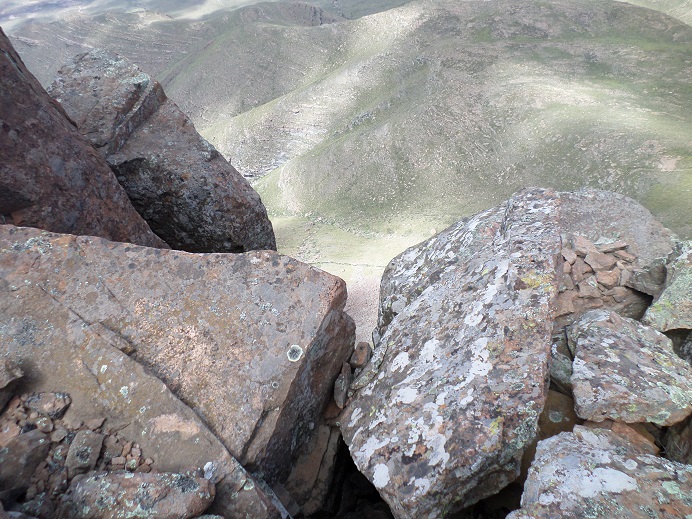
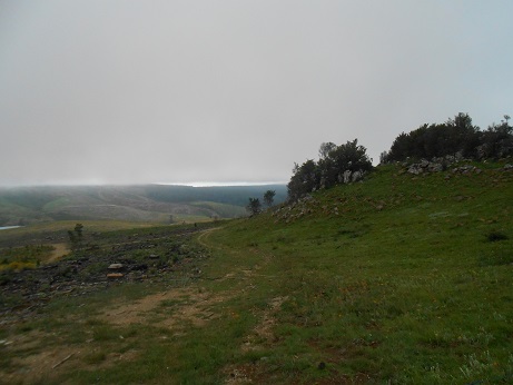
The skies cleared a little toward lunchtime so we went back up the mountain for some photos. The pics of the top of Ben Machdui below were all taken at lunchtime on the 31.
New years eve and we decide to make sure the bar stocks what we need. They do. What they don’t tell us is that they are closed! There must have been some sort of staff party or something, but there I was stone cold sober at the highest point in the Cape. Alone with Hennie the mountain man! Not even a staff member around the empty resort!
Early to bed and early to rise. After another impressive display of thunderbolts and lightning, very very frightning (sorry for the Queen lyrics) we awoke in the new year to the weather from the old year – storming.
We had to leave early today as we had to get down the mountain (back to Rhodes) and then to Hogsback to do Meinziesberg in the afternoon. We snapped up some contacts and headed for the bright lights of the Rhodes metropolis below us. But the trip would not be without some lessons.
One of the smaller bridges had washed away. Well not away, just out of the road. Some 4×4 vehicles climbing up to the top (fishing is popular at the dam) simply turned around. One family stopped to chat to us and I was given some sound advice…
“Ek so nie daar in gaan nie oom” (I would not go in there uncle) from a strapping young man in his mid twenties. I then pointed out that not only were we at the top and needing to go down, but that I also did not sleep with his aunty. We decided to rebuild the road and Hennie drove across where 4x4s feared to tread. Yay! Our very own superhero!
Due to the road building – which was new for me – we arrived much later than expected. We made it through to Hogsback and onto Menziesberg in time to activate by 8pm local time. What was very exciting was that on just 5W we chatted into Namibia. Let me say that again: On 5W we chatted to Namibia!
After activating Menziesberg (ZS/EC-010) we headed off with the fairies at a local camping site. Some welcome beer broke the then year-long dry spell. Some pizza for supper and we slept well. Too well!
Friday morning, 2 January 2015. Time to get up Tor Doone (ZS/EC-012). We slept late and were a little late getting up to the summit. We got there and once again (although this time by sked) we chatted to Namibia. It was also nice to chat to Andrew (ZS2G) my usual activation partner as well.
About lunchtime we left Hogsback and travelled home. Tired, but having really enjoyed ourselves. I learned a lot – from Peter and from Hennie so a big thank you to both of you!
A basic list of the activations:
31 Dec 2014 – Ben Macdhui (ZS/EC-001, 3001m)
01 Jan 2015 – Ben Macdhui (ZS/EC-001, 3001m)
01 Jan 2015 – Menziesberg (ZS/EC-010, 1645m)
02 Jan 2015 – Tor Doone (ZS/EC-012, 1565m)

Guess who? Guess where? Guess why?

Hennie – bigger the Tiffindell itself!

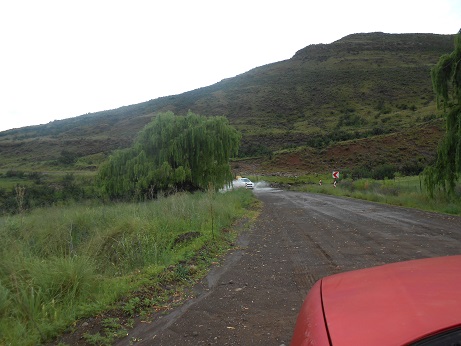
View on the way to Tiffindell
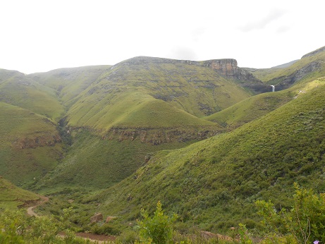
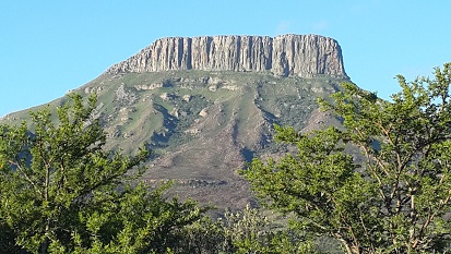
Mountains near Tiffindell

Audi 4×4 legend!

Trust me it was still in Tiffindell

Welcome to Rhodes – the middle of nowhere
Ben Macdhui is 3001m!
A lot of water all over the area

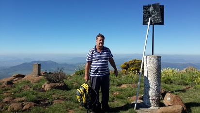
Guess who just spoke to Namibia on 5W?

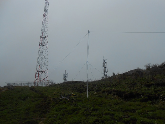
SOTA Antenna

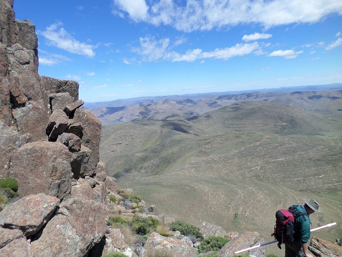
The view from tor Doone

Theft is rife in hogsback, so everything in the boot!

Hennie talking on his radio
The view from Menziesberg
More bad weather: Menziesberg
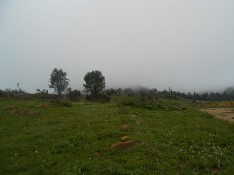
More bad weather: Menziesberg

Rhodes

4×4 road from Tiffindell

A little challenging, but overcome
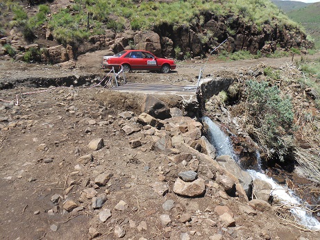
The legendary Audi 4×4

A shameless advert for the best skimming service in East London 😉
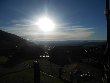
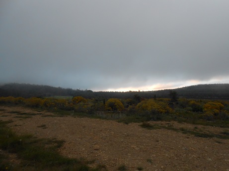
An early start – sunrise over Tiffindell ski resort

Anyone can camp, but to camp in the rain you need to be nuts!

Tiffindell under water 😉
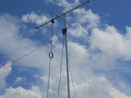
The 2m Yagi we never got to use!

Our Tiffindell home base

The highest pub in SA and closed for new years eve!

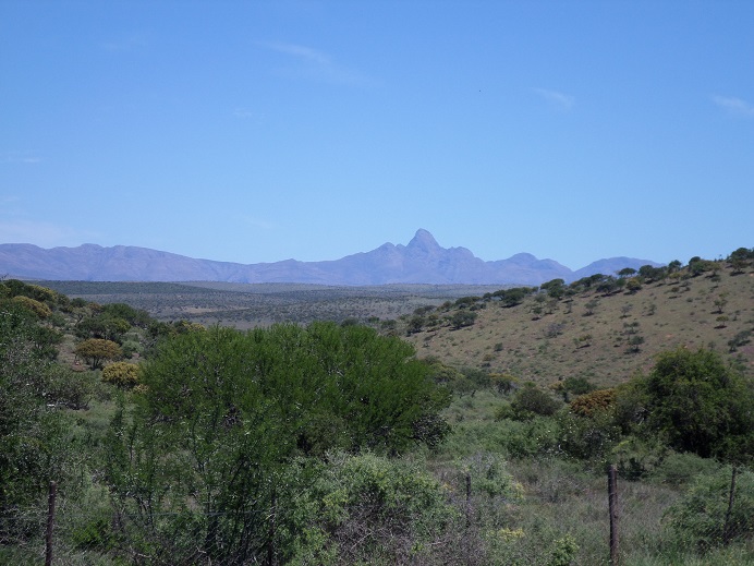
Tiffindell as seen from Ben Macdhui

The view from Ben Macdhui